
 KVUE News
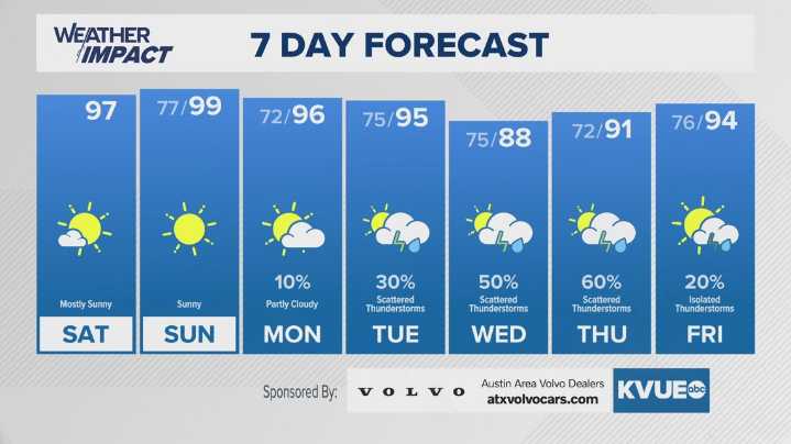
AUSTIN, Texas — We're tracking a very hot and hazy weekend across Central Texas, as a plume of Saharan dust comes into our region after crossing the Atlantic from North Africa, where an area of low pressure sits under an area of high pressure, creating strong upper level easterly winds while placing that part of the world in monsoon season.
With that, we'll have a vivid sunset Saturday evening, but air quality will not be the best, so for those with chronic lung conditions, you may want to limit outdoor exposure. Additionally, highs on Saturday and Sunday will be close to those triple digits, with Sunday being the more likely day for it.
However, an active pattern is forecast for next week, with our best storm chances coming midweek, and long-range model data shows the heaviest rain fall

 Queen City News
 WTKR
WTKR WAFB
WAFB AlterNet
 Deadline Business
 The Jerusalem Post