
 News 4 San Antonio
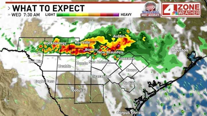
SAN ANTONIO - It could be another slow, wet commute for parts of our area Wednesday morning including Bexar County. Storms are underway ahead of a cold front in North Texas and moving south.
Storms are expected to fill in along the front in a line or complex as they push south toward our area. Severe risk is highest north of our area but we do have a low end level 1 of 5 severe storm outlook cutting across the Hill Country to the Edwards Plateau. Main hazard here is strong wind gusts with hail a secondary hazard if we do see warnings issued in the outlook. Overall biggest impact may be wet streets for the morning commute and for those that see downpours especially in Hill Country, some ponding on roadways.
Bexar County is not in this severe storm outlook. The expected trend is weakening