
 CNY Central Syracuse
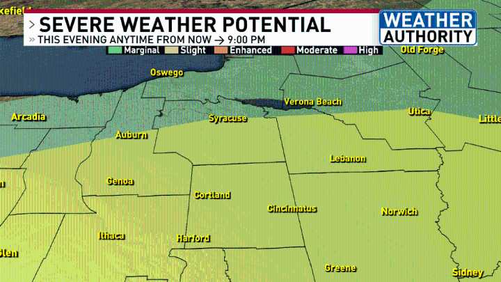
A lot of Thursday featured hazy sun, hot temperatures and high levels of humidity.
This evening the Weather Authority team is monitoring any thunderstorms on radar to see if and when any one storm may become severe.
Here is the Storm Prediction Center's map of which counties have the highest threat ( yellow shading ) and what types of impacts could come from a storm that's severe:
The main impact looks to be straight-line damaging wind gusts up to 60 mph.
Wind gusts of this level have enough force to knock down tree branches or even entire trees.
A few power outages may also occur from any downed utility poles or trees falling onto power lines.
The reason for this severe weather potential is a clash of the air masses between warm and humid air over us with cooler and drier air moving

 ABC 7 Chicago Politics
 FOX News Politics
 The Jerusalem Post