
 FOX Weather
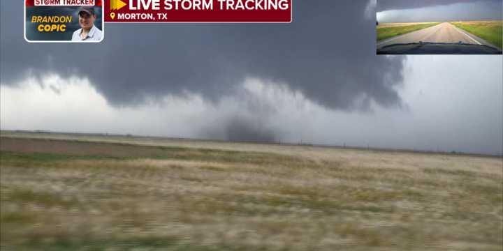
LUBBOCK, Texas – A powerful supercell thunderstorm trekked across eastern New Mexico and West Texas on Thursday, producing tornadoes, large hail, damaging winds and flash flooding.
The storm traveled more than 80 miles, producing its first tornadoes around Causey, New Mexico , and not giving up before reaching Lubbock, Texas, during the evening hours, where most of the impacts were felt.
The thunderstorm was one of several that developed across the Southern Plains, where the Storm Prediction Center had issued Severe Thunderstorm and Tornado Watches earlier in the day.
Despite the potential for showers and thunderstorms across much of the Lower 48, the most dangerous activity was centered over the Plains and West Texas .
PHOENIX HAS ALREADY HIT 100 DEGREES. WHAT DOES THIS EARLY HEAT MEA

 The Hollywood Reporter