
 WWSB
WWSB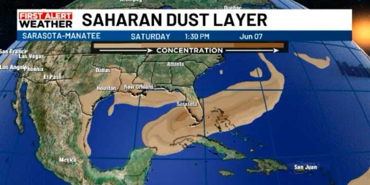
SARASOTA, Fla. (WWSB) - An upper-level low-pressure area has been instrumental in triggering showers and thunderstorms this week. This upper low combined with a surface trough to produce some very heavy rain showers, occurring at nearly any time of day. Those atmospheric features have now moved on. We’ve now established a pattern that is more typical of about 30% of our summer rainy season.
On this transition day, we can expect mostly inland rain chances. We’ll see a mix of sun and clouds, with highs near 90°F and heat indices ranging from 103 to 105°F. With the daytime heating, we can expect a good chance for afternoon storms. However, due to a westerly wind flow, these storms will quickly move inland and drift toward the east coast. Total rainfall amounts will be lighter than earlier in

 Daily Voice
 The Jerusalem Post
 FACTS.NET Sports
 New York Post
 Hello Magazine
 The Babylon Bee
 CBC News World
 Cache Valley Daily