
 KKTV 11 News
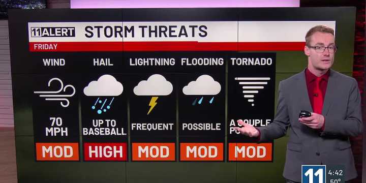
Strong to severe storms form around noon and move east.
All modes of severe weather are possible, including very large hail and tornadoes.
Warmer weekend, but storm chances remain.
FRIDAY: After a sunny morning, storms form near the mountains at noon and move east. These will quickly become strong to severe with all modes of severe weather expected: very large hail (baseballs over the Plains, golf balls along I-25), 70 mph winds and a few tornadoes. Flooding is also a possibility again. Highs in the 60s and 70s.
WEEKEND: Mostly dry and sunny Saturday, only an isolated storm is possible around the Pikes Peak Region in the afternoon. More storms expected Sunday with renewed severe weather chances. Highs rise into the 80s for most on both weekend days!
EARLY NEXT WEEK: Storm chances r

 USA TODAY National
 WSAV South Carolina
 The Cullman Tribune