
 Grist
Grist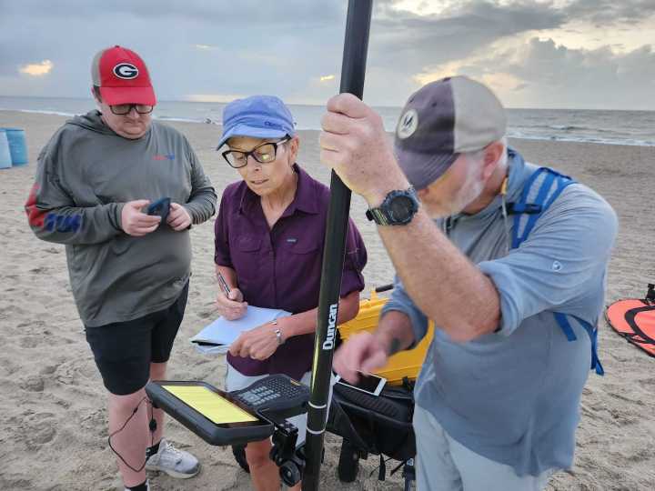
This coverage is made possible through a partnership between Grist and WABE , Atlanta’s NPR station.
At low tide on Tybee Island, Georgia, the beach stretches out as wide as it gets with the small waves breaking far away across the sand — you’ll have a long walk if you want to take a dip. But these conditions are perfect for a team of researchers from the University of Georgia’s Skidaway Institute of Oceanography.
Every three months, at low tide, they set out a miniature helipad near the foot of the dune and send up their drone equipped with LiDAR — technology that points a laser down at the sand and uses it to measure the elevation of the beach and dunes. The team flies it back and forth from the breakers to the far side of the dune and back until they have a complete, detailed ma

 The Columbian
 The Columbian Business
 Newsday
 People Human Interest
 The Newport Daily News
 Reuters US Top
 Orlando Sentinel
 KCRG Iowa
 The Hollywood Reporter Movies
 The US Sun Travel
 America News