
 Cedar City News
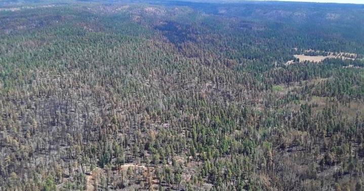
Interagency Burned Area Emergency Response teams from the Department of the Interior and U.S. Forest Service recently announced field data evaluations to produce the “Soil Burn Severity" map for the Dragon Bravo Fire.
According to a press release, the map field-verifies the accuracy of burn severity categories, ranging from unburned/very low, low, moderate, and high, from satellite images.
The data helps estimate post-fire risks, such as erosion, sediment washing into streams, increased stream flows, and the chances of debris flows, officials said.
“The soil burn severity map estimates approximately 9,851 acres (7%) of the fire is unburned/very low, approximately 97,724 acres (65%) have low soil burn severity, approximately 38,354 acres (26%) sustained a moderate severity, and approxima

 America News
 Reuters US Top
 FOX 5 San Diego
 CBN World
 The Daily Beast
 Press of Alantic City Business
 New York Post Video
 New York Post