
 WSVN 7 News
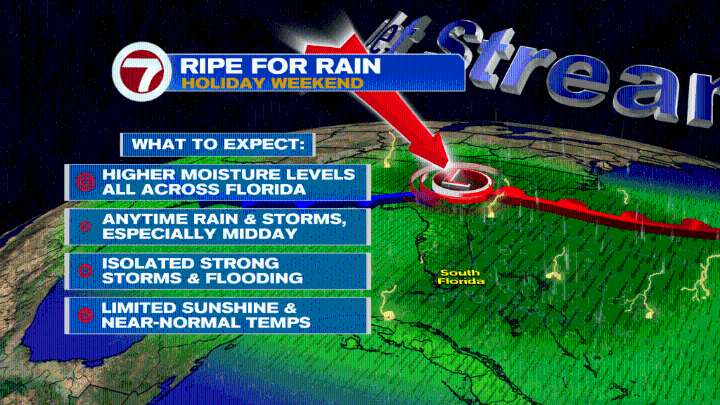
A front is stalling over Florida and along the that front there will be developing low. This will draw up a pool of moisture into the region leaving the air ripe for rain. Therefore, look for anytime rain and storms especially midday with the threat for isolated strong storms and flooding increasing across South Florida. As a result, temperatures will be near-normal with limited sunshine through Labor Day.
Today in the Tropics
The National Hurricane Center has issued the last advisory on Fernand since it has lost tropical characteristics in the Northern Atlantic and now we turn our attention to a wave currently over Africa. It is forecast to emerge into the Eastern Atlantic over the weekend with some slow development possible near or to the South of the Cape Verde Islands.
Have a wonder

 Florida Today
 People Shopping
 Daily Voice
 The Gleaner
 Columbia Daily Tribune
 FOX News Videos
 WESH 2 News
 The Fayetteville Observer
 Detroit Free Press
 KSL Utah
 Foreign Policy