
 KTIV News 4
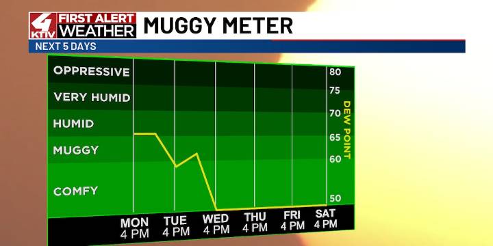
SIOUX CITY (KTIV) - We are warming up ahead of two strong cold fronts that will bring some thunderstorms and then cooler, drier air.
TONIGHT’S FORECAST
A stray shower or two possible early Monday night, otherwise slow clearing with fog developing toward dawn. Lows in the middle 50s.
TOMORROW’S FORECAST
Morning fog possible Tuesday. Mostly sunny and warmer, highs in the upper 70s. Storms move in by Tuesday night.
THIS WEEK
The first cold front arrives Tuesday night into Wednesday morning. This could fire up some thunderstorms, especially early Wednesday as it passes through. Skies will quickly clear Wednesday afternoon with highs in the middle 60s. Breezy through the afternoon as well, some wind gusts up to 35 mph possible. This cold front will basically wipe out the humidity for the

 CBS News
 NECN Providence
 Raw Story
 ESPN Golf Headlines
 Vogue Runway
 The News Virginian Politics
 Sweetwater Now
 5 On Your Side Sports