
 NBC Right Now
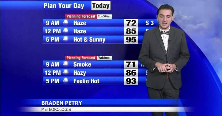
EXTREME HEAT WATCH IN EFFECT FROM TUESDAY MORNING THROUGH THURSDAY EVENING Starting on Labor Day, the focus turns to warmer temperatures and the possibility of isolated thunderstorms in central Oregon. As the previously mentioned low-pressure system moves westward, an upper-level disturbance is expected to pass through from Tuesday evening into early Wednesday, bringing another chance for showers and storms across much of southern Oregon, although most of Washington should stay mainly rain-free. Temperatures will definitely be the main story as upper 90s to triple digits will be likely Tuesday-Thursday, hence the extreme heat watch.
Tri-Cities:
Monday: Mostly sunny, haze. .. 95/66
Tuesday: Mostly sunny, haze.. 99/67
Wednesday: Sun.. 101/68
Thursday: Sunny.. 99/69
Friday:

 FOX News
 AlterNet
 KPTV Fox 12 Oregon
 Associated Press US News
 FOX 5 Atlanta Crime
 FOX 32 Chicago Crime
 KTLA
KTLA Raw Story
 IMDb Movies