
 WXYZ Detroit
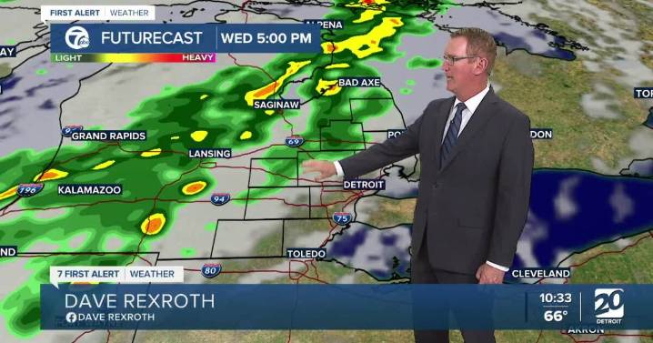
After many days with high pressure in control of our weather, changes are on the way for Wednesday. The high moves east and gives way to a storm system and trailing cold front from the northwest. After a dry start in the morning, clouds will increase through the afternoon ahead of the cold front. Showers and a thunderstorm chance arrive late afternoon or in the evening. Heavier rain could fall overnight. Severe weather is not expected, but localized half inch amounts are possible.
Cold air filters in behind the front dropping high temperatures into the mid to upper 60s Thursday. Another system quickly moves across the state Friday, bringing a slight chance for showers across Metro Detroit. High temperatures will be in the upper 60s to low 70s then. We are back to the 60s for highs this we

 The Washington Post
 The Oregonian Public Safety
 WCBI-TV
 Gainesville Sun
 WTOP
WTOP El Paso Times
 Local News in California