
 KIMT News 3
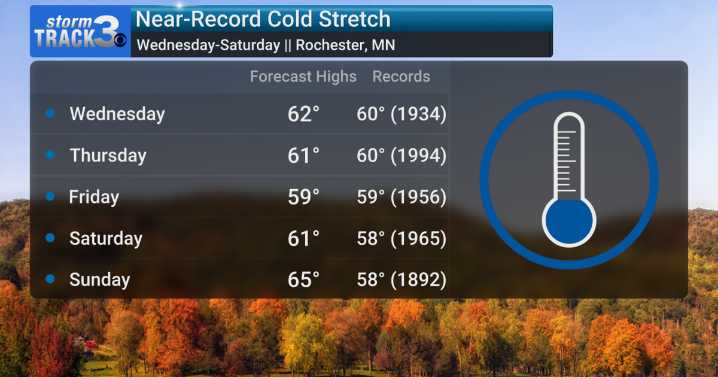
(KIMT) -- A potent low pressure system is set to bring midweek weather whiplash to SE Minnesotans and North Iowans. An associated Canadian polar air mass will allow for the coolest air of the season so far to linger into the weekend.
High temperatures are slated to fall to near-record territory Wednesday through Saturday in Rochester, MN. Each day features a forecast high temperature within a few degrees of the current daily record lowest-ever high temperature for each day. Some records date back to the 1930s!
Low temperatures are not expected to put records in jeopardy, but conditions will be cold enough for the potential of the first patchy frost of the season to form. Thursday and Sunday mornings may feature low temperatures in the 30s for some! It is time to break out those heavier w

 Raw Story
 Newsmax TV
 The List
 LiveNOW from FOX Crime
 Local News in California