
 CBS Philly
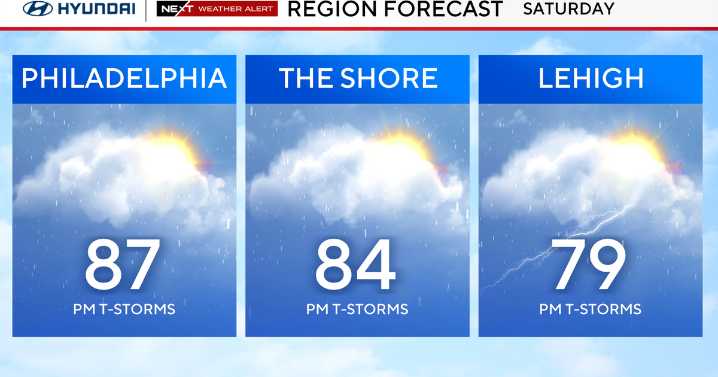
Saturday is another warm and humid day in the upper 80s to near 90s with more showers and storms crossing the region in the afternoon and evening as a strong cold front approaches, then crosses the area.
As the storms develop, the biggest threat will be damaging winds, but the Storm Prediction Center also has small chances for large hail and an isolated tornado.
CBS News Philadelphia.
Flooding rains may also be an issue, so stay weather aware.
Models continue to hint at the front stalling Saturday night into Sunday morning as a new low develops offshore. This would keep rain chances in the forecast Saturday night and likely showers lingering into Sunday morning, if not midday.
CBS News Philadelphia.
By late Sunday afternoon, much cooler and drier air arrives with clouds giving way to

 Butler Eagle
 FOX 29
 Local News in California
 KQED Politics
 The Babylon Bee