
 KXAN News
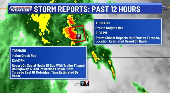
AUSTIN (KXAN) — We are almost halfway through the month of September, and a weather pattern continues with some tropical mischief possible in the Atlantic and Eastern Pacific Basin.
Severe Weather
A Tornado Watch has been issued for parts of North Dakota through Sunday evening.
Storm reports tornadic damage in both South Dakota and North Dakota. At 2:08 p.m., a storm chaser reported a multi-vortex tornado.
The Storm Prediction Center has general thunderstorms possible on Monday, with a level 1 out of 5 marginal severe threat on Tuesday for portions of the Central Plains.
Tropics
In the Atlantic Basin, an area of disorganized showers and thunderstorms has a high chance of tropical development. The next name is Gabrielle.
In the Eastern Pacific Basin, Tropical Storm Mario continues to

 Click2Houston
 Raw Story
 AlterNet
 WBAL-TV 11 Baltimore Entertainment
 CNN Politics
 ABC 7 Chicago Entertainment
 People Shopping
 New York Post Video