
 Nola Business
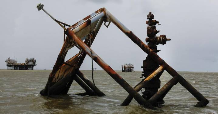
A Times-Picayune analysis found that more than 3,600 oil wells drilled on land or in marsh are now in open water.
To do so, the newspaper used the U.S. Geological Survey’s historical shoreline maps . We plotted the well locations using Department of Energy and Natural Resources well data, which include the well’s “spud date,” or the date on which drilling began.
For each well, we compared its spud date with the most recent shoreline map available prior to that year to determine whether it was originally drilled on land or in water. For example, a well drilled in 1976 was compared with the 1975 shoreline. There are some large gaps in historical shoreline maps: For wells drilled in the 1940s, the only available map is from 1932, which likely introduces some inaccuracies.
To determine wh

 CBS News
 Reuters US Domestic
 New York Magazine Intelligencer
 NFL Detroit Lions
 The Daily Beast
 RadarOnline
 The Intercept