
 KPAX
KPAX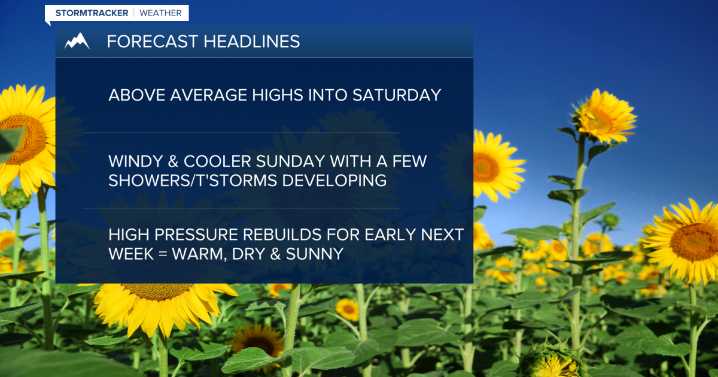
MISSOULA — Warm, sunny and dry conditions will continue through Saturday with highs topping out in record high territory for some in the upper 70s to upper 80s! Breezy conditions look to develop by the afternoon with gusts in the 15-25mph range.
Sunday will feature a bigger (albeit brief) change in our otherwise “high pressure dominated” forecast as a Pacific trough of low pressure/cold front blasts through. It will bring gusty west winds of 25-40mph creating choppy conditions on area lakes - especially Flathead Lake where 2’-4’ wave heights are likely.
Erin Yost
We’ll also see the development of scattered showers and thunderstorms along the frontal passage with highs dropping quite a bit behind it into the upper 60s to low 70s.
Erin Yost
With a cooler airmass in place, Monday morning

 FOX News
 News 5 Cleveland Politics
 NBC News
 The Conversation
 AlterNet
 NBC News Video
 ESPN Golf Headlines
 5 On Your Side Sports
 ESPN MLB Headlines
 The Daily Beast