
 USA TODAY National
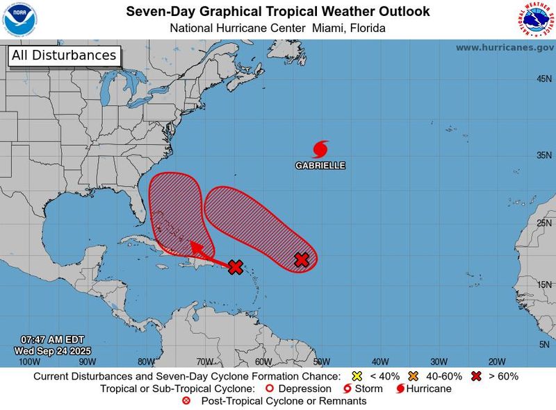
The dance between developing storms in the Atlantic could soon evolve into one of meteorology's most unusual and rare events: The Fujiwhara effect, which occurs when two storms interact with one another.
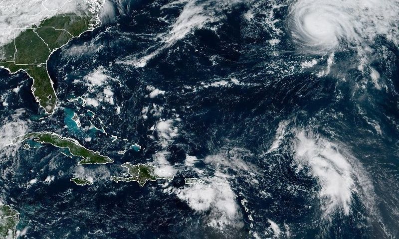
As of the morning of Sept. 24, two tropical systems continue to meander in the southwest Atlantic Ocean. Neither is a named storm yet, so they're dubbed "Invest 93L" and "Invest94L" by the National Hurricane Center. Both are highly likely to become tropical cyclones in the next week, the hurricane center said, but their exact paths and potential to impact the United States remain uncertain for now.
When and if the storms reach tropical storm status, one will likely be named Humberto and the other Imelda.
Many weather models show the potential for land impacts mainly from 94L (likely Imelda) but the track is dependent upon 93L (Humberto) with the “Fujiwhara effect determining the outcome," said Weather Trader meteorologist Ryan Maue in an Substack post Sept. 24.
"The Fujiwhara effect is uncommon in the Atlantic but can occasionally happen," noted WPLG-TV hurricane specialist Michael Lowry in a Substack post Sept. 24.
What is the Fujiwhara effect?
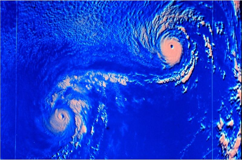
When two storms or hurricanes spinning in the same direction pass close enough to each other, they begin an intense dance around their common center known as the Fujiwhara effect, the National Weather Service said.
The effect is thought to occur when storms get about 900 miles apart.
Storms involved in the Fujiwhara effect are rotating around one another as if they had locked arms and were square dancing. Rather than each storm spinning about the other, they are actually moving about a central point between them, as if both were tied to the same post and each swung around it separately of the other.
A good way to picture this is to think of two ice skaters who skate quickly toward each other, nearly on a collision course, grab hands as they are about to pass and spin vigorously around in one big circle with their joined hands at the center.
According to Weather.com, the stronger storm often dominates, tugging the weaker one into its circulation, but in rare cases, two storms of similar strength can combine, creating a single, more powerful storm.
Who was Fujiwhara?
The effect is named after Dr. Sakuhei Fujiwhara who was the chief of the Central Meteorological Bureau in Tokyo, Japan, shortly after the First World War. In 1921, he wrote a paper describing the motions of "vortices" in water. Water vortices, such as whirlpools, are little water whirls that spin around.
What's the forecast for the two systems?
"Both Invest 93L and 94L have high chances of developing in the coming days," noted Houston-based meteorologist Matt Lanza in his Substack "The Eyewall" on Sept. 24. "And the situation has grown no less complicated."
"The first thing I can say with some confidence about all this is that we are looking at a somewhat lengthy process here," Lanza said. "We may be watching these systems for the next week. While Invest 93L seems likely to not be a land threat (though it could tease Bermuda), it may ultimately help influence Invest 94L, which could be a land threat on the Southeast or Mid-Atlantic coasts."
However, "even if 94L stays weak and offshore next week, the upper-level pattern with a cutoff low pinching off over the Tennessee Valley could funnel abundant tropical-laden air into the Carolinas and parts of the southern and central Appalachians and Mid-Atlantic for the start of next week," Lowry said.
"This suggests an enhanced flood threat for these areas beginning this weekend, which we’ll need to follow over the coming days," he added.
This article originally appeared on USA TODAY: Hurricane forecasters watch for rare, chaotic Fujiwhara effect
Reporting by Doyle Rice, USA TODAY / USA TODAY
USA TODAY Network via Reuters Connect

 KCEN TV
 Newsday
 The Spokesman-Review
 WVLT
WVLT STAT News
 Aljazeera US & Canada
 AlterNet
 CNN
CNN