
First radar images from new Earth-mapping satellite showcase Maine coast and North Dakota farmland Updated 13 mins ago NASA has released the first radar images from a new Earth-mapping satellite showing the Maine coast and North Dakota farmland in incredible detail. The pictures are from a spacecraft that rocketed into orbit from India two months ago. The joint U.S.-Indian mission will survey virtually all of the world's land and ice masses multiple times. By tracking even the slightest shifts in land and ice, the satellite will give forecasters and first responders a leg up in dealing with natural disasters. NASA says the pictures released Thursday are a preview of what's to come once science operations begin in November.
First radar images from new Earth-mapping satellite showcase Maine coast and North Dakota farmland
 The Traverse City Record-Eagle2 hrs ago
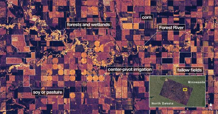
2

 LiveNOW from FOX Crime
 SpaceNews
 RadarOnline
 Mediaite
 US Magazine
 POPSUGAR