
 Star Beacon
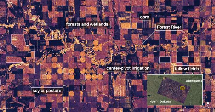
CAPE CANAVERAL, Fla. (AP) — NASA's first radar images from a new Earth-mapping satellite show the Maine coast and North Dakota farmland in incredible detail.
The pictures, released Thursday, are from a spacecraft that rocketed into orbit from India two months ago.

 LiveNOW from FOX Crime
 SpaceNews
 Mediaite
 FOX News Politics
 Vogue
Vogue The Daily Beast
 The Babylon Bee
 Vogue Shopping