
 News4JAX
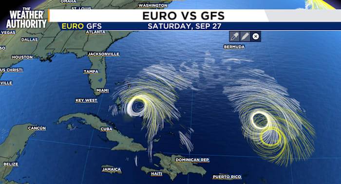
Invest 94 is taking shape in the Central Caribbean Sea and Southwestern Atlantic. The showers and thunderstorms have increased in association with the tropical wave located near Hispaniola and the Turks and Caicos Islands.
An area of low pressure is expected to form along the wave tonight or early Friday when it moves near the southeast Bahamas.
This low is expected to become a tropical depression when it is in the vicinity of the central and northwest Bahamas late Friday or over the weekend and then track northwestward or northward over the southwestern Atlantic.
There is significant uncertainty in the long-range track and intensity of the system as well as the impact from wind, rain and potential storm surge for the southeast U.S. coasts.
Continue to monitor the progress of the syste

 America News
 The Newport Daily News
 The Advocate
 Florida Today
 Sarasota Herald-Tribune
 KSNB Local4 Central Nebraska
 Daily Kos
 Breitbart News