
 The Post and Courier
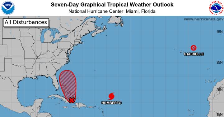
A cluster of Atlantic thunderstorms likely will consolidate and start spinning counterclockwise in the next few days, transforming Invest 94L into a named storm — although there’s still much uncertainty surrounding the system’s forecast.
That storm could veer in the direction of the South Carolina coast, according to early spaghetti models from the National Hurricane Center. The odds seem high enough that local agencies are beginning to plan for any potential impacts.
The National Weather Service’s Charleston office warned in a mid-day update Sept. 26 that much about the storm is still “VERY uncertain.” But the potential impacts of 94L include prolonged heavy rainfall, storm surge, strong winds (especially along the coast) and tornadoes.
The office is advising coastal residents to prepa

 Star Beacon
 People Human Interest
 FOX 13 Tampa Bay Crime
 CNN
CNN ABC 7 NY
 FOX Weather
 Greensboro News and Record
 CBN World
 The radio station 99.5 The Apple
 The List