
 Space War
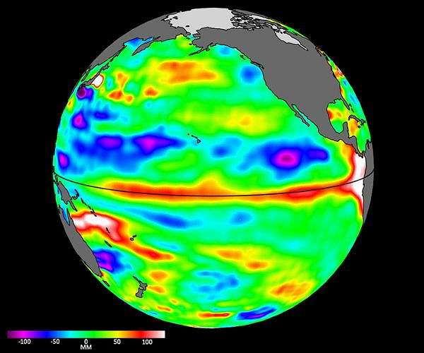
Sea surface height data from the Sentinel-6B satellite, led by NASA and ESA, will help with the development of marine weather forecasts, alerting ships to possible dangers.
Because most global trade travels by ship, accurate, timely ocean forecasts are essential. These forecasts provide crucial information about storms, high winds, and rough water, and they depend on measurements provided by instruments in the ocean and by satellites including Sentinel-6B, a joint mission led by NASA and ESA (European Space Agency) that will provide essential sea level and other ocean data after it launches this November.
The satellite will eventually take over from its twin, Sentinel-6 Michael Freilich, which launched in 2020. Both satellites have an altimeter instrument that measures sea levels, wind s

 Spectrum Bay News 9 Technology
 The Daily Beast
 FOX News Politics
 The Hill
 NBC 6 South Florida Sports
 New York Post
 AlterNet