
 ClickOrlando
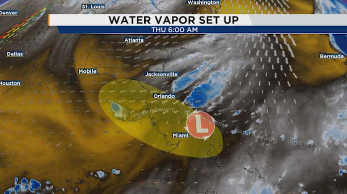
ORLANDO, Fla. – Very early Thursday morning, the National Hurricane Center has put Florida underneath a yellow formation cone once again.
A weak disturbance is currently located off our southeast shores, with some subtle counter-clockwise rotation with it. Tracking two new spots in the tropics as October kicks off
While development chances are fairly low for the time being, we’ll have to see what takes shape into this weekend. Regardless, we’re in for some hearty rain totals because of the system itself and its combined efforts with high pressure steering moisture in from the west Atlantic.
There’s a bit more to this set up than meets the eye. On the water vapor, you can see the overlayed outlook from NHC themselves, and where the leftover frontal "fragments" are helping to try and c

 FOX 51 Gainesville Crime
 FOX 13 Tampa Bay Crime
 CBS4 Miami
 FOX 35 Orlando
 Law & Crime
 Orlando Sentinel
 WWSB
WWSB Raw Story