
 News4JAX
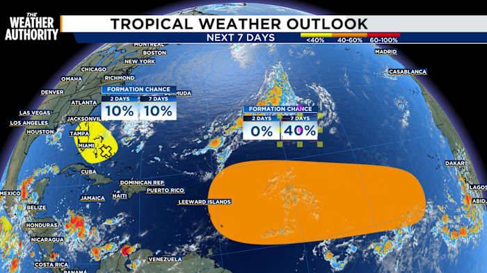
A broad area of low pressure is being monitored by the National Hurricane Center just off Florida’s east coast, with the possibility that it could drift westward into and across the the Florida peninsula. Currently, the odds of it developing into a tropical cyclone are modest: some forecasts place a 10 % chance in the next 48 hours to 7 days.
Even if the system doesn’t mature into a named storm, it is expected to enhance rainfall across Florida and possibly produce localized flooding. As it moves inland, land interaction and atmospheric shear should inhibit stronger tropical organization, limiting it more to a rainmaker than anything else. After crossing Florida, the remnants may emerge into the Gulf of Mexico where further changes are possible (though again, development chances appear lo

 Associated Press US and World News Video
 LiveNOW from FOX News
 Gainesville Sun
 Space.com
 Eyewitness News 3
 Fox 26 Liberty County
 FOX 32 Chicago
 WKYT
WKYT AlterNet