
 FOX 35 Orlando
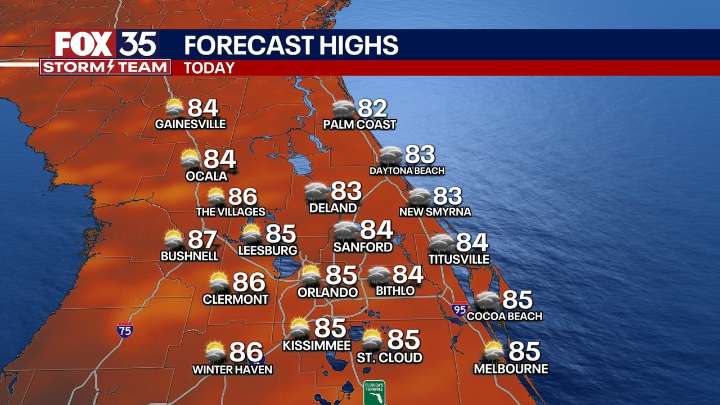
The Brief
ORLANDO, Fla. - Central Florida will see an active weekend with elevated chances for showers and a few thunderstorms, thanks to a strong easterly breeze and lingering moisture from Tropical Storm Imelda.
What will the weather look like tonight?
What to Expect:
A strong easterly wind off the ocean will drive numerous, fast-moving showers throughout the day. Flood Watches are in effect along the coast through Sunday morning.
The wind, combined with remnants of Imelda to the northeast, will bring high surf and a heightened rip current risk, with High Surf Advisories in effect through early next week.
Temperatures will be slightly cooler than normal, topping out in the mid-to-upper 80s, with overnight lows in the mid-to-upper 70s. As daytime heating fades, the shower threat w

 FOX 13 Tampa Bay Crime
 TMZ
TMZ Salon
Salon WWSB
WWSB FOX News
 Florida Today
 Law & Crime
 The Daily Beast