
HASTINGS, Neb. (KSNB) - It was a warm and windy day today with temperatures back into the mid to upper 80’s. Winds are strong around 20 to 30 mph with gusts up to 45 mph at times. Winds will stay strong ahead of the cold front as it slowly moves through into tomorrow. That cold front is currently producing showers and storms across the panhandle. There is a marginal risk for severe weather with those storms across western Nebraska. The cold front sweeps east into tomorrow morning with a chance of some showers lingering across central Nebraska tomorrow morning. Temperatures tomorrow morning cool into the 40’s and 50’s to the west and staying in the 60’s to the east. Behind the cold front temperatures stay in the 50’s and 60’s across western and northwestern Nebraska. Mid to upper 70’s acros
Big changes on the way as a cold front moves through tonight and tomorrow
 KSNB Local4 Central Nebraska2 hrs ago
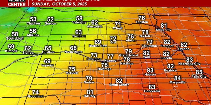
70

 New York Post
 AlterNet
 Essentiallysports College Sports