
 FOX Weather
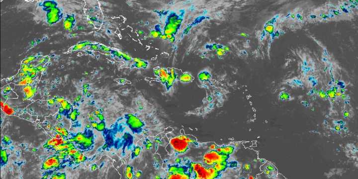
As the peak of the Atlantic hurricane season winds down, meteorologists will begin turning their attention to the waters surrounding Central America, where a broad area of low pressure known as the Central American Gyre (CAG) could form in the coming weeks.
A Central American Gyre typically develops once or twice during the hurricane season, often in the early and late months, and can trigger a range of hazardous weather conditions, including tropical cyclones.
Even without spawning a named tropical system, the sprawling circulation can bring days of torrential rain, flooding and mudslides to more than a dozen countries across the Americas.
The broad pattern can last for several days and more than a week, allowing copious amounts of tropical moisture to accumulate across the region.
WH

 Newsday
 CNN Health
 ABC News Weather
 America News
 AlterNet
 NECN Entertainment
 Insider
 The Daily Beast
 NBC News NFL