
 News4JAX
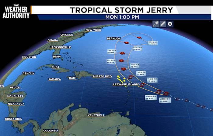
Tracking Tropical Storm Jerry. The last location was near latitude 14.3 North, longitude 53.7 West.
Jerry is quickly moving toward the west-northwest near 23 mph and this is expected to continue through early Thursday.
A turn toward the northwest and then north while slowing down late Thursday into Saturday.
On the forecast track, the center of Jerry is expected to pass near or northeast of the northern Leeward Islands late Thursday.
Maximum sustained winds are near 60 mph with higher gusts.
Gradual strengthening is forecast during the next few days, and Jerry could become a hurricane.
Tropical-storm-force winds extend outward up to 125 miles from the center.
The center passed just south of NOAA buoy 41040, which measured a sustained wind of 47 mph and a gust to 54 mph.
The estimat

 10 Tampa Bay
 America News
 ABC News US
 TownTimes news.com
 MSNBC
MSNBC