
 KPAX
KPAX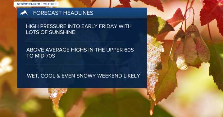
MISSOULA - High pressure has settled in, allowing for mainly clear skies, patchy morning fog, and warming temps!
Watch the forecast: Weather Forecast: 10.8.25
Highs should top out in the mid-60s to low 70s on Wednesday and Thursday.
The ridge will begin to flatten on Thursday, allowing a southwesterly flow with a little moisture to develop. This will increase cloud coverage a bit for Friday and allow for an isolated thunderstorm or two to develop during the afternoon/evening for mainly Southwest Montana.
Highs will remain warm, topping out in the upper 60s to almost mid-70s for Friday.
Erin Yost
As of now, the weekend looks to feature a BIG pattern change to unsettled & cool conditions as a trough of low pressure moves in.
Snow levels will start off quite high on Friday, around 9

 CBS Sacramento CBS13
 KOMU 8
 Billings Gazette
 Independent Record
 KXLH
KXLH America News
 The Babylon Bee
 Glam
Glam AlterNet
 CBS News
 Raw Story
 NewsChannel 5 Nashville Sports