
SALT LAKE CITY (ABC4) — Happy Thursday, Utah! We will see a day of transition in Northern Utah, as wet weather has already moved in overnight and is impacting parts of southern Utah already this morning. Our SW flow returned and brought temperatures back to average, and today highs will be above average for a bulk of the Beehive State. The SW flow has also dragged some deep, tropical moisture from what was Hurricane Priscilla into Utah. Deep moisture in place means scattered thunderstorms and showers are ahead with an increasing flood threat today and even more so for Central, Eastern and Southern Utah for Friday. The flash flood threat for popular recreation areas in Southern Utah has gone up with a probable risk for places like Zion, Bryce Canyon, Capitol Reef and Grand Staircase. Arches
Deep tropical moisture surges into the state with heavy rain and an increasing food risk ahead
 ABC4 News5 hrs ago
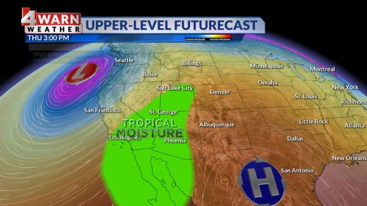
63

 KSL Utah
 KSL NewsRadio
 FOX News Politics
 5 On Your Side Sports
 CNN Politics
 Atlanta Black Star Entertainment
 Law & Crime