
 FOX Weather
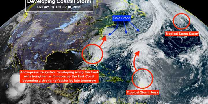
Updated 9:30 a.m. on Friday, Oct. 10, 2025.
A non-tropical area of low pressure is developing near the Central Florida east coast along the cold front that's pushing south. The low and its associated dip in the jet stream are in the configuration that often produces strong nor'easters along the Mid-Atlantic coast up to New England in the winter.
This is not a developing tropical storm because it's connected to the front that divides the cool Canadian air to the north and the moist tropical air to the south. It's that contrast that is powering the developing storm much more than the energy gained from the warm ocean.
The low is forecast to begin its move to the north tomorrow. Meanwhile, the strengthening low will whip the cold front through South Florida by tomorrow night, heralding a c

 America News
 ABC News US
 TownTimes news.com
 Reuters US Top
 The Week Politics
 ABC 7 Chicago Entertainment
 AlterNet
 New York Post