
 FOX 4 News Arlington
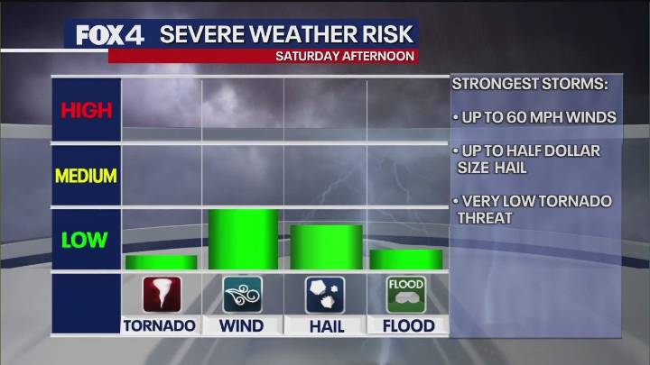
The Brief
Strong to severe thunderstorms are expected to move through North Texas today, with the biggest concern between noon and 6 p.m.
The highest risk for severe weather, including damaging winds and half-dollar-sized hail, is in zones east and southeast of the DFW Metroplex.
Cooler, clear weather will follow the storms, with temperatures dropping into the 50s and a high of 75 degrees expected tomorrow.
DALLAS - North Texas is bracing for a cold front expected to bring strong to severe thunderstorms, primarily impacting areas east of the Dallas-Fort Worth Metroplex this afternoon and early evening. While computer models initially showed a weaker system, forecasters have increased rain and thunderstorm coverage, noting a "marginal risk" for most of North Texas and a "slight risk"

 Breitbart News
 FOX 26 Texas
 Reform Austin
 KENS 5
 KFVS12
 Fox 26 Liberty County
 WFAA
WFAA NPR
NPR El Paso Times
 NBC Southern California
 NBC News