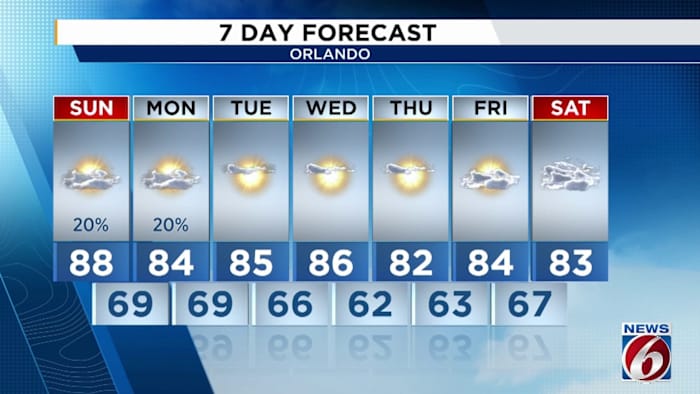
ORLANDO, Fla. – Winds have already started to change as our next cold front makes its approach from the northwest. Currently, it’s centered over the Deep South and Dixie Alley Regions, dumping heavy rain and producing severe weather tonight.
Thankfully, we won’t receive any of the nasty weather, but our chance for some isolated showers and stray thunderstorms will pick up, especially tomorrow after about 5 p.m. There's been a distinct change in our wind flow across the state, showing the presence of a front and supporting upper level trough nearby (Copyright WKMG 2025)
The front is slated to start sliding across the Florida panhandle in the morning, and by 2 p.m. we’ll probably begin to see the nose of that cool pool back behind the cold front showing up on radar northwest of Gainesv

 ClickOrlando

 FOX 13 Tampa Bay Crime
 AlterNet
 WWSB
WWSB KNOE
KNOE WFTV Channel 9
 Democrat and Chronicle Sports
 Reuters US Top