
 KIMT News 3
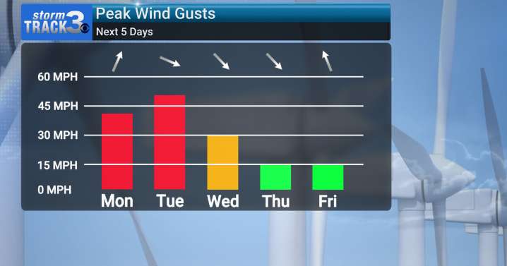
(KIMT) -- We've got a busy next few days of weather on our hands here in SE Minnesota and North Iowa! To start, we already saw those winds increase Sunday... well, the windy pattern will continue through Tuesday as a potent low pressure system approaches from the west.
Winds will strengthen out of the south Monday, gusting up to 40 MPH at times, allowing temperatures to climb into the low 60s by the early afternoon. Morning sunshine will give an early boost to temperatures, but a quick increase in clouds throughout the afternoon will prevent those temperatures from climbing any higher.
Once the low passes overhead, a wave of precipitation will pass through the region Monday afternoon/evening along a cold front. This will not be a soaking rain as the band of precipitation will be moving r

 America News
 FOX 10 Phoenix Latest
 Florida Today
 FOX 32 Chicago
 KSNB Local4 Central Nebraska
 WHAS 11
 WNNY-TV
 WSIL-TV
 WRCB-TV
 Essentiallysports Football