
 Space.com
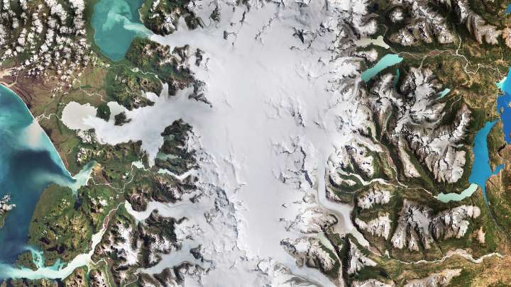
For decades, satellites orbiting hundreds of miles above Earth have provided scientists with a crucial vantage point to monitor our planet's frozen landscapes. Missions like NASA's Landsat and the European Space Agency's Copernicus Sentinel are particularly valuable for studying glaciers, vast dynamic rivers of ice that are sensitive to changes in temperature and precipitation.
What is it?
In a recent image released by the European Space Agency, the Copernicus Sentinel-2 satellite captured an image of Chile's Laguna San Rafael National Park. Spanning approximately 10,500 square miles (17,000 square km), the park lies along Chile's Pacific coast and in the Patagonian region. Its ice fields feed into 28 outlet glaciers, including the two largest glaciers seen in the image: San Rafael and S

 ScienceAlert en Español
 America News
 Florida Today
 Asheville Citizen Times
 Desert Sun News
 NewsNation
 Reuters US Business
 Raw Story
 Mediaite