
 4 News Now
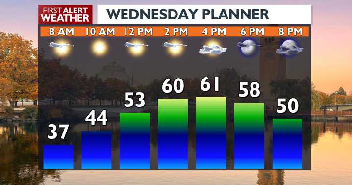
Today may be our last combination of warm and sunny weather for a while. Clouds begin to roll in on Thursday ahead of a big storm this weekend around the Pacific Northwest.
What We're Tracking
The Inland Northwest will experience a shift from mild and dry conditions to cooler temperatures, breezy winds, and widespread precipitation starting Thursday night and lasting into early next week. In the meantime, expect sunshine and 60s on Wednesday, followed by cloudier and slightly cooler conditions on Thursday.
Travel will become more difficult this weekend as snow levels drop and bring slick, frozen conditions to all of our mountain passes by Sunday night. It will be cold enough on Monday that we could even see a tease of winter in a few high valleys.
Plan Your Wednesday
Extended Foreca

 KXLY 4 News
 America News
 Associated Press Top News
 Corpus Christi Caller-Times
 WAND TV
 AccuWeather Severe Weather
 Kitsap Sun
 WYMT
WYMT Breitbart News