
 THV11
THV11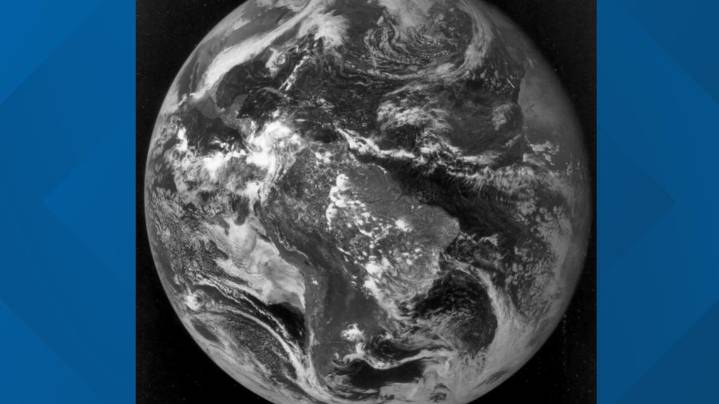
JACKSONVILLE, Fla. — Fifty years ago, on Oct. 24, 1975, meteorology took a monumental leap forward when GOES-1 (Geostationary Operational Environmental Satellite), the world’s first geostationary weather satellite, returned its first image from space. That moment marked a turning point in how scientists observed and forecasted weather around the globe.
Before GOES-1, weather satellites were polar orbiters, beginning with TIROS-1 in 1960. Polar-orbiting satellites circle the Earth from pole to pole, capturing detailed images as the planet rotates beneath them. While they provided valuable data, each satellite could only view a specific location twice a day, leaving large gaps in real-time monitoring.
Geostationary satellites, by contrast, orbit about 22,300 miles above the equator at

 CBS Colorado
 @MSNBC Video
 Associated Press US News
 AlterNet
 OK Magazine
 Raw Story
 The Daily Beast
 Delaware Sports
 CNN
CNN People Travel