
 KIMT News 3
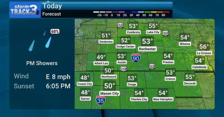
(KIMT) -- Hopefully, you were able to get outside to enjoy Monday's sunshine! Not much (if any) sunshine will be seen Tuesday as clouds stream in from the south ahead of a stalling cold front. This front will look to stall west of the I-35 corridor, keeping most of the coolest and wettest weather out of SE Minnesota and North Iowa.
Expect highs in the upper 40s to the west with low to mid 50s to the east as rain is less likely the farther east you go for much of the day.
Most will see rain Tuesday, but you might have to wait until the evening for that to occur as wraparound moisture from an upper level low to our south rolls in. Around 0.25" of rain or less is expected for many.
Drier weather returns for the rest of the work week with lighter northerly winds. This will bring about some

 Daily Voice
 WILX News 10
 Roswell Daily Record
 K2 Radio Local
 Cowboy State Daily
 Detroit Free Press
 The Progress-Index
 FOX 13 Tampa Bay Crime
 WABI
WABI RadarOnline