
 CNN Climate
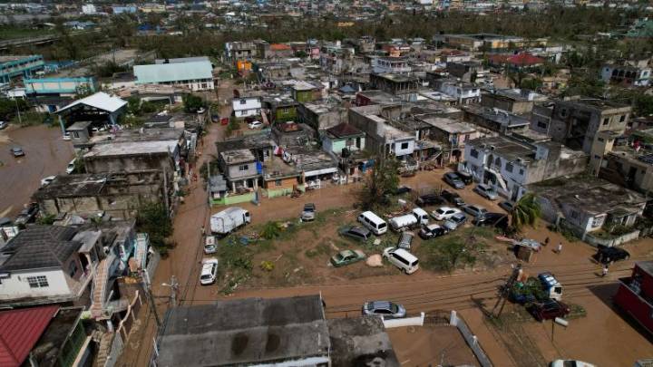
A drone view shows streets covered with mud, after Hurricane Melissa passed the Catherine Hall community in Montego Bay, Jamaica, on October 29. Sandra Stojanovic/Reuters
Hurricane Melissa left a trail of destruction as it moved across Jamaica, seen for the first time from space in new satellite images obtained from Vantor.
The storm made landfall in Jamaica on Tuesday as a monstrous Category 5 hurricane before moving onto to Cuba on Wednesday and later, the Bahamas.
These aerial images show widespread flooding and extensive damage in towns along Jamaica’s southwest coast in the parish of St. Elizabeth and, on the opposite side of the island in Montego Bay, the capital of St. James parish. The storm first made landfall on Jamaica’s southwest coast near the town of Black River, seen in

 CBS4 Miami
 FOX News Videos
 PBS NewsHour World
 America News
 Associated Press Top News
 FOX Weather
 KICKS 105
 KTVU San Francisco
 KOLO8
KOLO8 Page Six
 Bozeman Daily Chronicle Sports