
 WLFI News 18
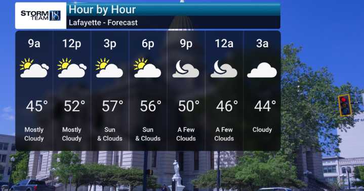
Breezy conditions will persist today with see wind gusts reaching up to 30-35 mph, making it feel quite raw and chilly with a few possible showers towards the southeast.
The good news is, we anticipate this active weather will wind down. Rain chances will continue into tonight and Thursday, but by Thursday afternoon, things should start drying out as high pressure builds in from the west.
Friday and Saturday are shaping up to be dry and pleasant. We're expecting seasonably cool temperatures through the weekend, so definitely not seeing any extremely warm or unusually cold anomalies for this time of year. However, don't put those rain jackets away just yet! Models suggest wetter conditions could return late in the weekend into early next week.

 Reuters US Top
 America News
 Associated Press Top News
 Rolling Stone
 ABC News
 Associated Press US and World News Video
 NBC Bay Area Dixon News
 FOX Weather
 Reason Magazine