
 WMTV NBC15
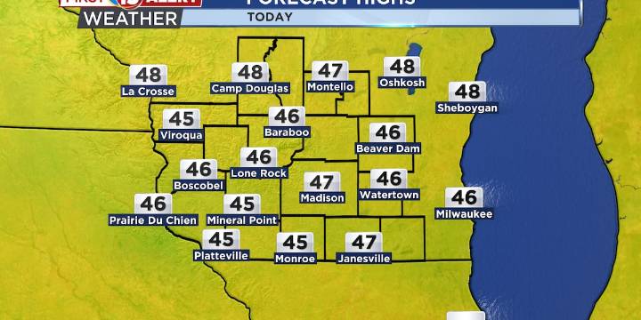
Today’s high temperatures will be in the mid and upper 40s
Next chance of rain arrives late Sunday night into early Monday morning
Temperatures trending above average through next week
MADISON, Wis. (WMTV) - An upper-level disturbance located near La Crosse early this morning is moving southeast toward the Quad Cities. At the surface, a weak front extends from the Wisconsin Rapids to Oshkosh and Manitowoc. These two systems will work together today to produce scattered rain and drizzle across southern Wisconsin. Showers will be more widespread near Lake Michigan, where lake influences will help to enhance lift. With this, we could even see a few rumbles of thunder over the southern portion of the lake.
By this evening, the front will shift south of the area, allowing drier air to move

 Local News in Arizona
 NPR
NPR FOX 10 Phoenix Latest
 KSNB Local4 Central Nebraska
 CBS4 Miami
 WKYT
WKYT KPLC
KPLC FOX 26 Texas
 NBC Chicago
 AlterNet