
 WCBI-TV
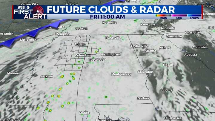
COLUMBUS, Mississippi (WCBI) – Bringing in a higher rain chance for the end of the week. There is potential for a few to become strong to severe. Not all will even experience rain.
THURSDAY NIGHT: Moisture continues moving North, aiding in the development of clouds across the state. This will also help to keep temperatures a little warmer tonight, with lows dropping into the low to middle 50s.
FRI/SAT: Afternoon highs will hold on the warmer side into the weekend, returning to the upper 70s. This first front will increase rain chances as the week comes to an end. The rain will be isolated to scattered at times, some potentially bringing strong storms. Damaging wind is the highest concern with the Level 1 Marginal risk both Friday and Saturday.
SUNDAY: Another front is expected to push i

 FOX 26 Texas
 The Weather Channel
 Deseret News
 WSMV 4 Nashville
 K2 Radio Local
 WSAZ NewsChannel 3
 Aljazeera US & Canada
 AlterNet
 FOX 8 News