
 KPAX
KPAX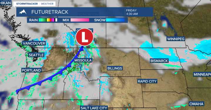
MISSOULA — A quick moving cold front will bring mountain snow, valley rain and breezy winds to western Montana today.
The front will move through between 4 am - 8 am meaning this is when the most widespread precipitation will be seen.
By late morning and afternoon expect a mix of sun and clouds along with a few scattered showers and breezy winds with gusts around 25-to-35 mph.
A drier pattern looks to set up for the weekend as a weak ridge of high pressure builds, expect temperatures in the 40s Saturday, then 50s Sunday.
Taking a quick look at next week, a warm weather pattern looks to set up with highs in the mid to upper 50s and even a few low 60s possible Monday and Tuesday.
After these highs, look to remain in the 50s through the week.

 Bozeman Daily Chronicle
 NHL Montréal Canadiens
 New York Post
 AlterNet
 CNN Business
 The Atlanta Journal-Constitution Sports