
 West Kentucky Star
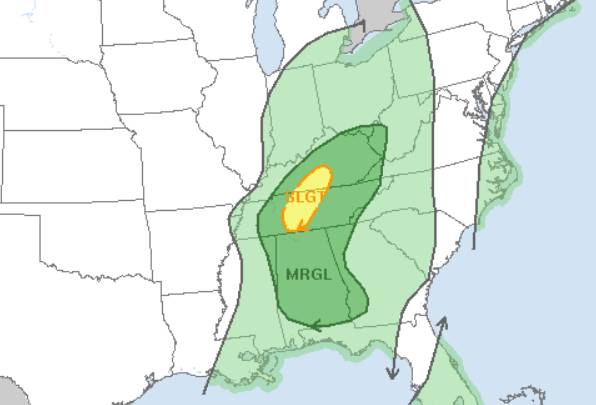
The National Weather Service is looking for a few storms in our area today, but an earlier concern for the possibility of severe weather has shifted to central Kentucky and Middle Tennessee east of Nashville.
A cold front passage today will bring chances for showers and a few thunderstorms but most areas will likely remain dry.
Another small chance of rain is possible Saturday night into Sunday morning.
After that, a brief but bitter Arctic airmass will bring the coldest temperatures of the season Sunday and Monday. High
temperatures Monday may struggle to climb into the 40s with lows in the 20s.
Wind chill values in the teens are forecast both Monday and Tuesday mornings.
Temperatures will recover to a gusty 54 on Veterans Day, and back to the 60s by next Thursday.

 WESH 2 News
 WRCB-TV
 Times Herald-Record
 LEX 18 News
 WCNC Charlotte Weather
 WAND TV
 Talk 95.3 MNC
 The Weather Channel
 Dickson County Source
 Fox 11 Los Angeles Sports
 FOX 32 Chicago
 The Fashion Spot