
 21Alive News
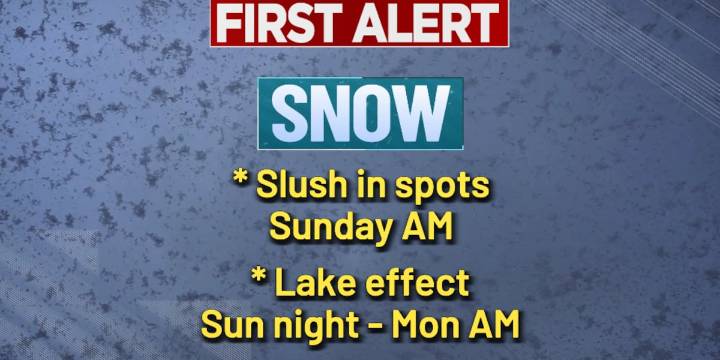
FORT WAYNE, Ind. (WPTA) - The forecast remains as on track as a meteorologist would hope for regarding our brief rendezvous with winter this weekend! There are still some specifics to iron out, however. Let’s dig in!
SATURDAY THROUGH SUNDAY MORNING
The weekend starts off cloudy and calm with highs reaching the low 50s. The relatively mild day, on the heels of what is expected to be a relatively mild night compared to where we’ve been, will actually play a part in what happens next.
Rain will spread into the area after sunset Saturday and continue overnight. As this happens, colder air will start filtering in and will likely transition the rain to some moderate, wet snow. Not only are overnight temperatures expected to stay above (or, perhaps briefly right around) freezing, but the prece

 Associated Press US and World News Video
 WAND TV
 The Journal Gazette
 WTHR Crime
 WTHR
WTHR The Times of Northwest Indiana Crime
 AlterNet
 Fortune