
 CBS Philly
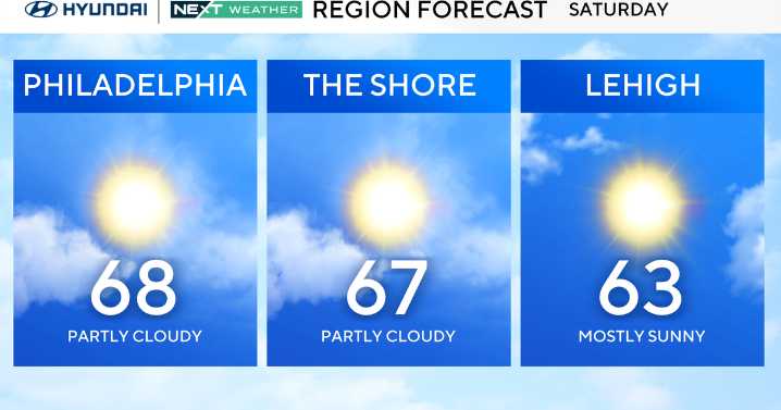
A weakening front has moved offshore early this morning with full sunshine now returning. Highs will climb well into the 60s with a light breeze, making for a pleasant day overall.
Clouds increase again tonight as the next low-pressure system begins developing to our west and south.
Most of the region stays dry overnight, though a few light showers could brush northern and southern areas toward daybreak. Lows will settle in the 40s.
Sunday turns unsettled as a stronger cold front approaches. Expect more widespread showers, a few rumbles of thunder, and a brief burst of gusty winds as the front moves through at night.
Much colder air follows on Monday with highs falling through the 40s, a brisk northwest wind, and the possibility of a few flurries in the higher elevations, mainly toward

 Daily Voice
 Reform Austin
 ABC 6 WPVI-TV
 New York Magazine Intelligencer
 The Daily Beast