
 WIS News 10
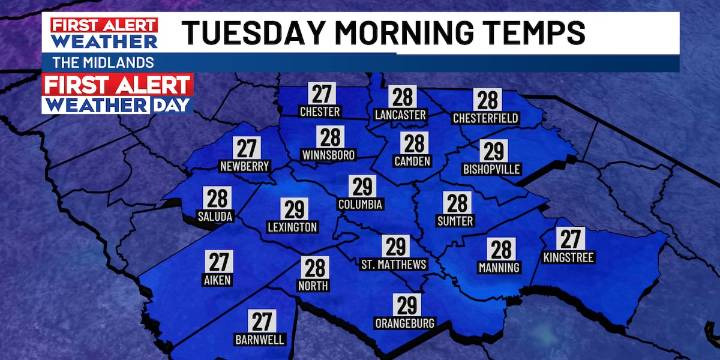
COLUMBIA, S.C. (WIS) - Tracking the risk of a few strong storms this evening before a significant cool-down arrives for the new work week.
First Alert Headlines
Chance of thunderstorms this evening, a few which could becoming strong or severe.
Well-above average warmth for Sunday ahead of a strong cold front.
First Alert Weather Day for Tuesday morning for first freeze of the season.
First Alert Summary
Our first of two cold front has stalled out just to the north of the Midlands today. This will keep a chance of a few showers and isolated thunderstorms in the forecast through this evening. All of the area is included under a ‘Marginal 1/5 Risk’ for this storm threat.
The second cold front is on track to approach from the west on Sunday. High temperatures Sunday afternoon will rise

 WSPA 7News
 @MSNBC Video
 AlterNet
 Raw Story
 5 On Your Side Sports