
 21Alive News
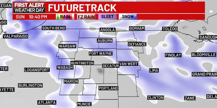
FORT WAYNE, Ind. (WPTA) - We saw one round of snow on Sunday morning, and other round is moving through on Sunday night into Monday morning. This round could add an addition 0.5-2″ of snow, with higher amounts expected northwest of Fort Wayne.
This could create isolated slick spots and reduced visibility, at times, on the road. So, drive carefully!
The temperature overnight will drop in to the low 20s, with feels like temperatures in the low 10s by the time you’re heading out on Monday morning.
Expect a little break from the snow through lunchtime on Monday, then the lake effect snow starts up, continuing through early Tuesday morning. Some will see very little additional snow during this time, while others could experience another 1-3″ of snow, with more snow northwest of Fort Wayne.

 Los Angeles Times
 The Fashion Spot
 FOX News Politics
 ABC30 Fresno Sports
 The Conversation
 AlterNet
 Raw Story
 The Daily Mining Gazette