
 WFMJ-TV Politics
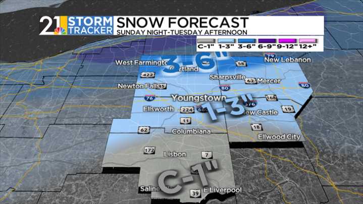
After rain changed to snow overnight Sunday, a very cold air mass has arrived in the area.
Monday should start rather dry, though a passing flurry is possible. Highs will peak in the mid-thirties- well below the airport's average high of 52 degrees. Winds will shift from Northerly to Northwesterly, setting the stage for established lake-effect snow by the evening.
This will be the main driver of snow accumulation, especially in areas north of Youngstown. A couple or few inches will be common, and the northern half of both Trumbull and Mercer counties could pick up even more.
As winds shift on Tuesday, lake-effect snow will become less favorable by the afternoon. Both days, regardless, will only have highs peaking in the mid-thirties, the area's coldest since early April. Skies will be m

 WSIL-TV
 KNOE
KNOE WBRC
WBRC FOX Weather
 The Bay City Times
 Hawaii News Now
 KOLO8
KOLO8 Reno Gazette-Journal
 CNN Climate
 NBC News
 The Daily Beast